

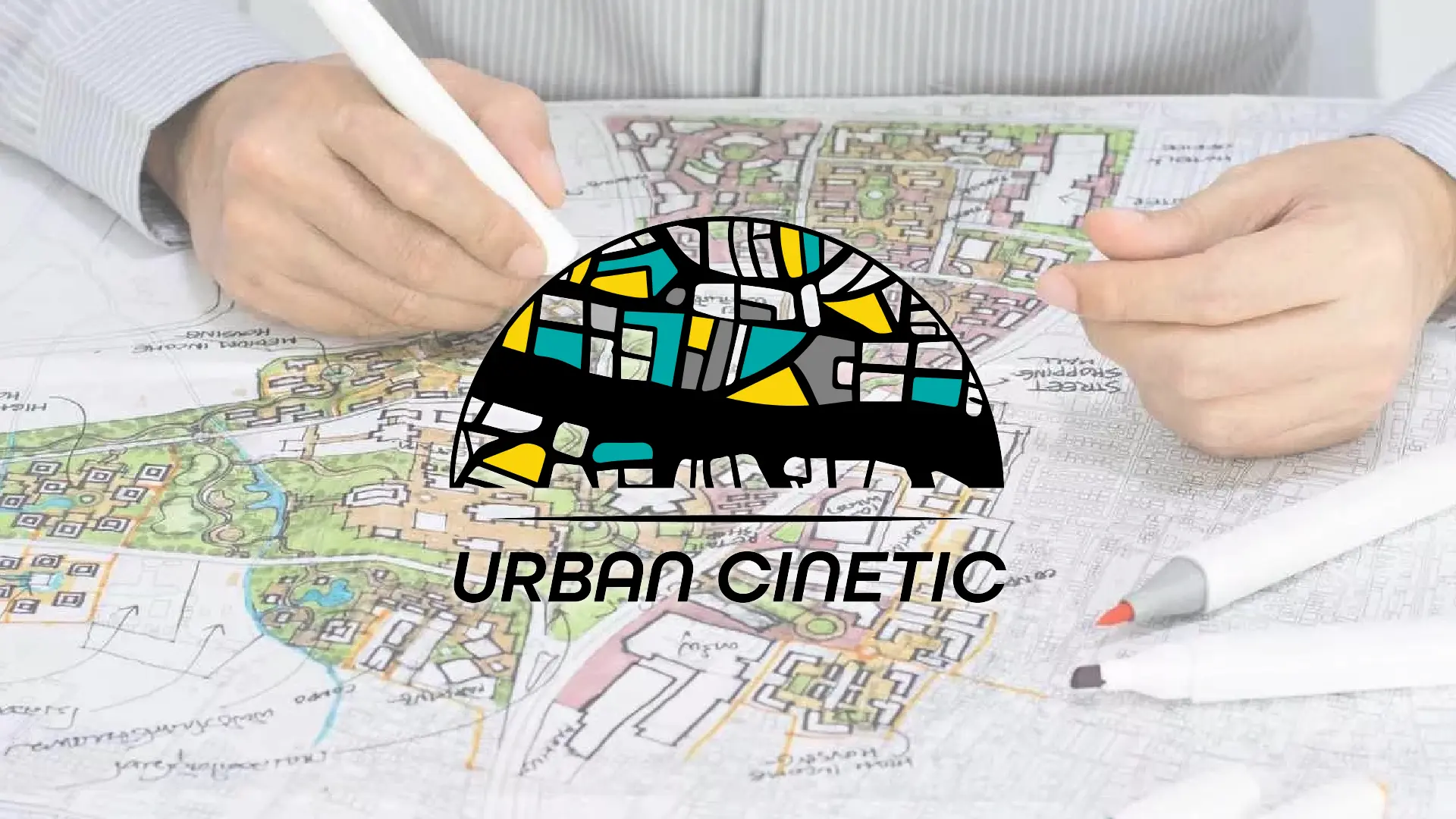
Urban Cinetic
Creation of a SaaS software for managing urban transformation projects: from strategy to full-stack development. THE CONTEXT: THE COMPLEXITY OF URBAN DEVELOPMENT OPERATIONS URBAN CINETIC is the first software designed specifically for managing urban transformation projects. Developed by urban planning practitioners, it meets the practical needs of developers, public land agencies, and local authorities faced […]
DELIVERABLES
Complete Artistic Direction
Website
Responsive and optimized website development.
Branding portfolio
Visual identity and brand guidelines creation.

Urban Cinetic
THE CONTEXT: THE COMPLEXITY OF URBAN DEVELOPMENT OPERATIONS
URBAN CINETIC is the first software designed specifically for managing urban transformation projects. Developed by urban planning practitioners, it meets the practical needs of developers, public land agencies, and local authorities faced with the operational, financial, and regulatory complexities of development projects.
Before URBAN CINETIC, urban development stakeholders relied on generic tools — spreadsheets, traditional GIS, file exchanges — unsuited to the reality of these multi-stakeholder projects:
- No unified cartographic vision: parcel data, regulatory constraints, and development scenarios were scattered across separate tools, making decision-making slow and risky.
- No scenario management: it was impossible to simulate, compare, and iterate on land consolidation or relocation hypotheses without manual data re-entry.
- Fragmented operational monitoring: land management, relocations, and planning relied on disconnected files, leading to errors and wasted time.
The objective was clear: create a high-performance, cartographic, and collaborative business platform capable of centralizing the entire lifecycle of an urban development operation.
OUR APPROACH: A CUSTOM DIGITAL ECOSYSTEM
1. A BUSINESS APPLICATION DESIGNED BY AND FOR PRACTITIONERS
SynergIn supported the creation of URBAN CINETIC in its entirety, from strategy to deployment. We defined the positioning, designed the visual identity, and developed the entire digital ecosystem.
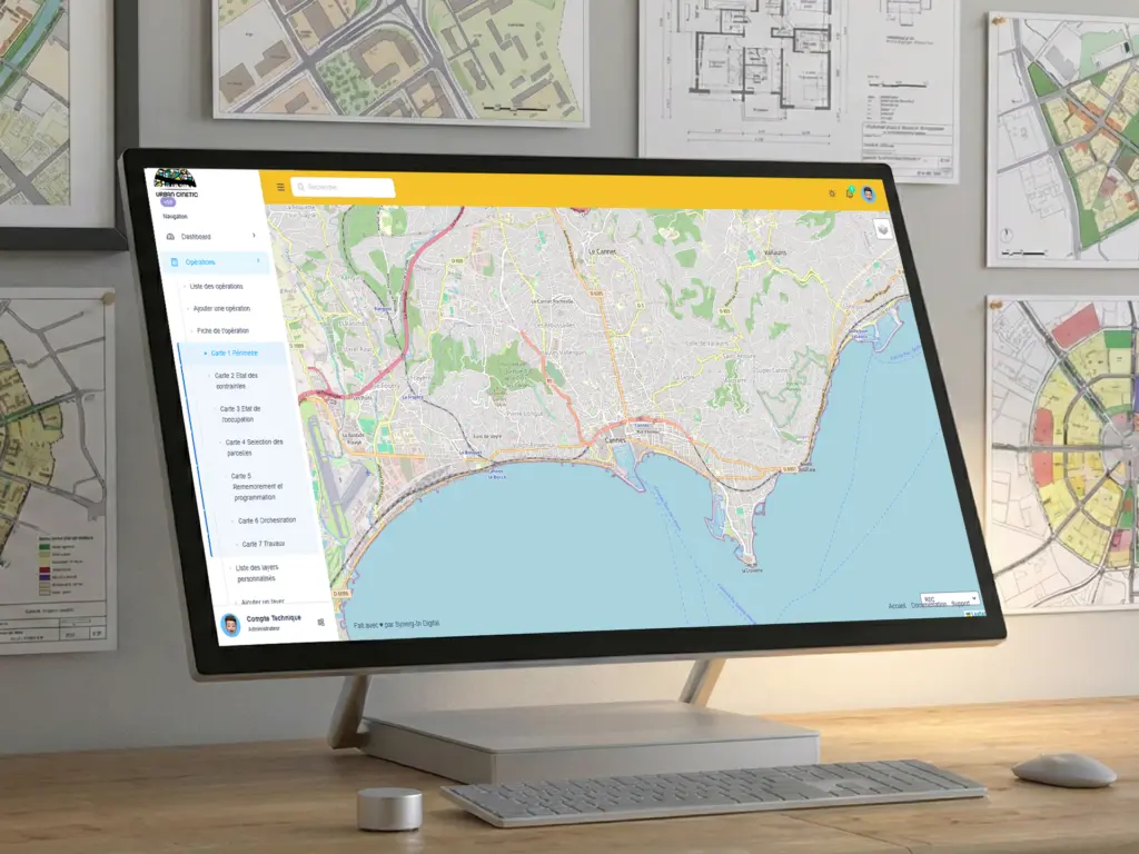
The application dashboard was developed in React, with a NextJS architecture guaranteeing performance, security, and scalability. The back-end runs on Express.js (Node.js) connected to a PostgreSQL database extended by PostGIS for geospatial data processing. The whole stack is containerized via Docker, with a TypeORM migration system ensuring evolutionary schema management. The user experience was designed to provide a clear reading of strategic data and facilitate decision-making in multi-stakeholder environments.
- Six interactive map views built on Leaflet, each dedicated to a key stage of the development project:
- Visualization of the operational perimeter and site survey.
- Mapping of regulatory constraints (local urban plan, flood risk prevention, hazards, easements, noise, pollution…).
- Parcel analysis with editable data tables and aggregated charts.
- Interactive selection of parcels involved in the operation.
- Land consolidation scenarios: parcel splitting and merging directly on the map, with versioned saving.
- Relocation orchestration scenarios with an interactive timeline, linked to planning scenarios.
- Advanced cartographic editing tools: edit mode with polygon splitting by line drawing (via Leaflet Editable and Turf.js), merging of adjacent parcels, geometry modification by vertex drag-and-drop — all with unsaved changes management and real-time synchronization between map and data table.
- A granular permissions system: access by operation, company, and role, ensuring data security and confidentiality in a multi-stakeholder context.
- GIS data import: support for Shapefile, GeoJSON, KML, GPX, DXF, and SQL formats with automatic reprojection via Proj4js, attribute mapping, and cartographic preview before import.
2. AN SEO STRATEGY TO TARGET URBAN DEVELOPMENT STAKEHOLDERS
At the same time, we designed the showcase website using WordPress, optimized for natural referencing on queries related to urban project management and software dedicated to developers. To attract qualified prospects, we worked on three axes:
a. Technical Optimization
- Loading speed: use of WebP format for images, activation of lazy loading, and minification of CSS/JS files.
- Tags and structure: optimization of title tags, meta descriptions, and alt text for images, with a clear H1/H2/H3 structure.
- Schema markup: addition of Schema.org SoftwareApplication markup to improve visibility in Google’s search results.
b. Expert and Engaging Content
- Detailed feature pages: each module (cartography, scenarios, land management) has its own page, with technical descriptions and concrete use cases, all written by our SEO expert.
- Specialized blog: creation of educational articles targeting high-potential long-tail keywords, such as “how to manage an urban development operation” or “land management software for local authorities”. These contents are entirely written by our SEO expert.
- Social proof: integration of testimonials from professional users and field experience feedback to strengthen the solution’s credibility.
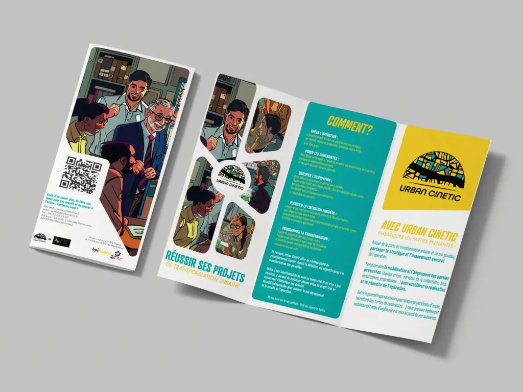
3. CROSS-MEDIA CONSISTENCY
The entire project was adapted for print media, notably a trifold brochure, to ensure communication consistency during the official launch at the EPL Congress in Nantes.
This project illustrates our ability to design complex digital solutions for local authorities and urban development stakeholders. At SynergIn, we don’t just develop tools: we build sustainable ecosystems where strategy, design, and technology work together to bring about projects with a strong local impact.


